Surveying Capstone project assisted archaeological research at Native American settlement
A group of Cincinnati State Land Surveying bachelor’s degree graduates is helping to bring Native American history back to life at a site near Lawrenceburg, Indiana.
As the Capstone project for their bachelor’s degree studies, five Land Suveying students completed work for the Archaeological Research Institute (ARI) that will provide a more visitor-friendly environment for future visitors to the site of a Native American settlement from the past.
Above (far left) is Marcus Schulenburg, ARI Senior Archaeologist, with CS student team members Rakeem Wright, Frank L. Sellinger II, Luke Strotman, Jared Foster, and Emerson Hoeweler.
ARI Executive Director Liz Sedler also assisted the CS team, along with Land Surveying Program Chair Dr. Carol Morman.
The Archaeological Research Institute is a non-profit organization based in Lawrenceburg, near an Ohio River site occupied by past cultures.
ARI offers to volunteers and students of all ages opportunities:
- to participate in unique and immersive hands-on research to unearth site artifacts and features
- to document and preserve the artifacts
- to take tours of local and regional archaeological sites
- to learn about and appreciate the cultures that lived in Ohio, Indiana, and Kentucky in the past
The CState Land Surveying students completed a boundary retracement survey to find and establish the corners of the ancient Native American settlement, and then completed a topographic survey to model the ground of the property. (See photos below.)
- The topographic survey makes it possible to see differences in the elevation of the ground, which aids in finding more artifacts and locating other features of the Native American settlement.
- With the help of ARI staff members Ms. Sedler and Mr Schulenburg, the CS team also mapped the locations of known buildings around the settlement, including what is thought to be a protective perimeter wall.
- Although the site is now surrounded by farmland, a previous magnetic survey uncovered evidence of the settlement and locations of huts and the protective perimeter wall.
- The boundary and topographic surveys completed by the CState team will help ARI staff members better understand the scale of the settlement, and also provide direction on how to incorporate a walking trail and parking lot for visitors when the site is open to the public in the future.
Team member Frank Sellinger said the Capstone project experience was “unique and insightful.”
Frank said, “I was licensed as a surveyor in 1995 and have worked on a variety of sites and projects, but none were quite like this archeological site.”
“It was a first for me to take on the challenges of seeing and locating a site that was covered by a thousand years of topsoil, while working with the procedures and instincts of six surveyors, and then culminating the experience with a 90-minute presentation to peers and our client,” Frank said.
“I can’t thank Cincinnati State enough for taking a risk and making classes like this Capstone interesting and available to us.”
He added, “I gained so much by being able to take a small part in the mission of ARI as they nurture appreciation of what happened in the past– what a noble idea!”
(Photos provided by Carol Morman)
-
 ,
,Site of Native American settlement, after spring rain and snow thawing -
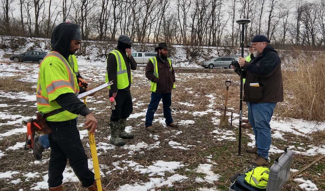
 explains the scope of the project to CS students") ,
,ARI staff member Marcus Schulenburg (on right) explains the scope of the project to CS students -
 ,
,Student team discusses plans for the project -
 ,
,Emerson Hoeweler and Luke Strotman review their notes -
Frank Sellinger II calibrates GPS to prepare for next steps in project